QUESTIONS? CALL OR TEXT! 1 (877) 921-6277 or (403) 266-2241
WE SHIP EVERYWHERE!


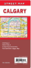
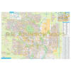
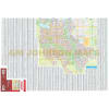
For reliable, offline navigation, this Folded Road Map is the definitive paper map for the Calgary metropolitan area. Designed for drivers and travelers who need a quick, detailed street map without relying on a battery or cell service.
This map provides current, comprehensive coverage of the city and its essential surrounding areas, including:
Rockyview County (rural roads, acreages, and communities)
Foothills County (South Calgary and adjoining communities like Okotoks, High River)
Downtown Calgary (a separate, large-scale street map insert for central business navigation)
Superior Offline Reliability: A durable, folded paper map that never runs out of batteries—perfect for glove compartments and emergency navigation throughout Southern Alberta.
Quick-Find Street Index: Easily and quickly locate any destination, street address, or point of interest using the comprehensive, user-friendly index.
Detailed Street-Level Clarity: Features all major thoroughfares, secondary roads, side streets, district lists, and clear points of interest (POIs).
Extended Regional Coverage: Beyond city limits, this map is an indispensable guide to the rural and municipal districts of Rockyview and the Foothills, including all adjoining communities.
Clear Downtown Insert: A focused, high-detail insert map makes navigating the complicated streets of downtown Calgary simple and efficient.