QUESTIONS? CALL OR TEXT! 1 (877) 921-6277 or (403) 266-2241
WE SHIP EVERYWHERE!


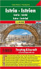
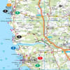
The Most Detailed Map of Istria: Istria Island Pocket
Dive deep into the "New Tuscany" with the Freytag & Berndt Istria Road Map AK7405. Presented in a convenient "Pocket" format, this map's incredibly fine scale of 1:100,000 (1 cm = 1 km) is unrivaled for detailed exploration of the Istria Peninsula and its rich cultural landscape.
Why the AK7405 is Essential for Istria:
Unmatched Detail: The 1:100,000 scale is ideal for cyclists, motorcyclists, and self-drive tourists looking to navigate the small, winding roads to hilltop towns like Motovun and Grožnjan.
Covers the Full Peninsula: Comprehensive coverage of the coastline, featuring the major ports of Pula, Rovinj, and Poreč, and extending to the Kvarner region with the historic town of Opatija.
Activity-Focused Features:Scenic roads are highlighted in color, cycling paths are clearly marked, and all registered campsites and tourist information centers are easily identified.
City Navigation Insets: Includes invaluable detailed street plans for key urban centers such as Umag, Poreč, Rovinj, Pula, and Opatija, ensuring stress-free arrival and departure.
Whether you're hunting for truffles in the interior forests, visiting Roman ruins, or relaxing on the coast, this map provides the precise, up-to-date guidance you need.