QUESTIONS? CALL OR TEXT! 1 (877) 921-6277 or (403) 266-2241
WE SHIP EVERYWHERE!


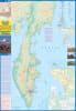
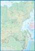
Explore one of the world's most remote, rugged, and volcanically active landscapes with this detailed Travel Reference Map of the Kamchatka Peninsula and Far East Russia. This map is an indispensable tool for adventurers, researchers, and travelers visiting a region where comprehensive cartography is scarce.
Kamchatka Peninsula Focus: Provides detailed geographic and logistical information for this massive region, known for its 160 volcanoes (29 active).
Far East Russia Context: Includes the surrounding areas of Far East Russia, offering crucial regional context for flight and research planning across the Kamchatka Kray and neighboring autonomous regions.
Terrain Clarity: Ideal for visualization and planning, featuring clear depiction of the mountainous terrain and coastal features.
Given the limited infrastructure in this region, the map focuses on key logistical necessities:
Roads: Clearly marks the sparse but critical major roads and tracks connecting key settlements like Petropavlovsk-Kamchatsky.
Settlements: Indicates the locations of remote villages, research stations, and major geographic points of interest.
Adventure Planning: Essential for planning multi-day hiking and trekking routes through the volcanic fields and wilderness areas.
Embark on your journey into one of the planet's wildest frontiers fully prepared. This map is the single most valuable reference for exploring the challenging and breathtaking landscape of the Kamchatka Peninsula.