QUESTIONS? CALL OR TEXT! 1 (877) 921-6277 or (403) 266-2241
WE SHIP EVERYWHERE!


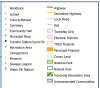
Known as the "Cradle of Ukrainian Settlement in Canada" and the "Church Capital of North America," Lamont County (County 30) is also a primary driver of Alberta's economy through its inclusion in Alberta's Industrial Heartland. This professional-grade landownership map is the definitive tool for navigating a landscape that balances world-class industrial pre-zoned land with highly productive agricultural acreage.
Surface Ownership Details: Every quarter section is precisely labeled with the current registered owner’s name—an invaluable resource for land agents, industrial developers, and agricultural producers.
Land Status Color-Coding: Navigate complex boundaries with instant visual clarity:
Freehold (Private): Clearly identifies privately held titled land and rural residential parcels.
Crown (Government): Highlights provincial and federal holdings.
Crown Leased: Specifically identifies government land under lease, critical for grazing and industrial access.
Urban Centers & Communities: Comprehensive coverage of the Towns of Lamont and Mundare, the Villages of Andrew and Chipman, and the Town of Bruderheim. Includes hamlets such as Hilliard, St. Michael, Star, and Wostok.
Industrial & Transportation Infrastructure: Features up-to-date road information, including Township Roads and Range Roads, plus Highway 15, Highway 16 (Yellowhead), and Highway 45. Includes major rail corridors and proximity to the Designated Industrial Zone (DIZ).
Heritage & Natural Landmarks: Detailed mapping of Elk Island National Park boundaries, the Ukrainian Cultural Heritage Village, and the county's famous historical churches.
| Category | Keywords |
| Primary | Lamont County Land Map, County 30 Map, Alberta Landowner Maps |
| Industrial | Industrial Heartland Site Selection, Bruderheim Energy Terminal, Dual Rail Service Map |
| Regional | Mundare Sausage Capital, Andrew Big Bird Map, Chipman Airstrip, Star Alberta Map |
| Navigation | Township and Range Roads Lamont, Victoria Trail History, ATS Grid Map |