QUESTIONS? CALL OR TEXT! 1 (877) 921-6277 or (403) 266-2241
WE SHIP EVERYWHERE!


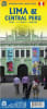


Maximize your Peru adventure with this highly practical, double-sided travel map. Designed for the modern traveler, this map combines a high-precision street plan of the capital with a vast regional road map covering the country's most famous destinations. It is the only resource you need to navigate from the coast to the Andes.
Navigate South America's gastronomic capital with confidence. This detailed street plan covers the areas most relevant to visitors:
Key Districts: Detailed coverage from the Historic Center (Centro de Lima) south to the popular tourist districts of Miraflores, San Isidro, and Barranco.
Public Transport: Essential for getting around the sprawling city, this map clearly displays the Metro Line 1 & 2 and the Metropolitano BRT (Bus Rapid Transit) network.
City Landmarks: Easily locate embassies, hotels, shopping areas, museums, and historic plazas.
The reverse side features a massive regional map designed to cover the classic "Gringo Trail" and beyond. It covers the central portion of Peru, extending:
East to Cusco and the Sacred Valley.
South to Pisco, Ica (Huacachina), and the mysterious Nazca Lines.
North past Trujillo and Cajamarca.
Key Regional Features:
Major Attractions: Specifically highlights Machu Picchu, Inca ruins, and the Cordillera Blanca for trekkers.
Topography: Features altitude coloring and spot heights to help you visualize the dramatic rise from the Pacific coast to the high Andes.
Road Network: Detailed road classification for bus travelers and self-drivers, including the new paved highway routes toward the Amazon.
Whether you are exploring the colonial streets of Lima or taking the bus to Machu Picchu, this map is your ultimate Peruvian travel companion.