QUESTIONS? CALL OR TEXT! 1 (877) 921-6277 or (403) 266-2241
WE SHIP EVERYWHERE!

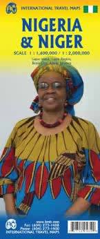


Navigate the diverse landscapes of the Gulf of Guinea to the heart of the Sahara. Our Nigeria & Niger Travel Map is a meticulously detailed, folded, and indexed guide designed for those who demand more than a digital screen. From the bustling megacity of Lagos to the ancient trade routes of Niger, this map is your essential survival and exploration tool.
Stop guessing your route. This map distinguishes between freeways, secondary roads, and rural tracks, providing a clear hierarchy for safe travel.
Infrastructure Essentials: Clearly marked railways, international and domestic airports, and even remote airfields for regional travel.
Driver Support: Find your way to the nearest gas stations, rest houses, and border crossings with ease.
Safety First: Includes vital locations for hospitals and medical facilities, essential for long-distance travel in remote regions.
Don't get lost in the urban sprawl. Our map features high-detail inset maps for:
Lagos & Lagos Island: Navigate the economic heart of Africa, from the high-rises of Victoria Island to the historic streets of Lagos Island.
Benin City: Expertly mapped for travelers visiting the historic seat of the Benin Empire.
Unlock the tourism potential of both nations with a legend packed with cultural and natural landmarks:
History & Faith: Discover archaeological sites, museums, mosques, and missions/churches across the region.
Nature’s Wonders: Includes boundaries and access points for national parks (like Yankari or W National Park), nature reserves, and coastal beaches.
Adventure Stays: From luxury hotels to remote camp sites and huts, know exactly where you can rest your head.