QUESTIONS? CALL OR TEXT! 1 (877) 921-6277 or (403) 266-2241
WE SHIP EVERYWHERE!



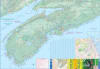

Experience the salt air and rugged beauty of Canada's East Coast with the most comprehensive Nova Scotia & PEI Travel & Road Map. Whether you’re crossing the engineering marvel of the Confederation Bridge or tracing the winding turns of the Cabot Trail, this map is designed to help you navigate the rich history and breathtaking landscapes of the Maritimes with ease.
Our map highlights the must-see destinations that define the East Coast experience:
Peggy’s Cove: Easily navigate to this iconic fishing village and find the best routes to the world's most photographed lighthouse.
The Cabot Trail: Get a detailed view of this world-class scenic drive through Cape Breton Highlands National Park, including marked viewpoints for mountain vistas and ocean cliffs.
Confederation Bridge: Plan your arrival on the "Garden Province" via the 13km bridge connecting the mainland to PEI.
Fortress of Louisbourg: Step back into the 18th century with clear directions to this immersive National Historic Site.
Green Gables Heritage Place: For fans of L.M. Montgomery, our map pinpoints the setting of Anne of Green Gables and the beautiful red-sand beaches of the PEI National Park.
Comprehensive Road Network: Covers all major highways, scenic coastal byways, and secondary roads—perfect for those "off-the-beaten-path" discoveries.
Tourism-First Legend: Find provincial parks, campgrounds, ferry terminals, historic sites, and local museums at a glance.
Reliable & Offline-Ready: No cell service? No problem. This physical map is essential for remote areas of Cape Breton and rural PEI where GPS can be spotty.