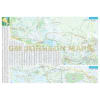
Ontario Detailed Road Map. The Ontario Detailed Road Map is an intricate and comprehensive cartographic representation that spans the diverse and expansive province of Ontario, Canada. This meticulously crafted map not only offers a comprehensive view of major cities such as Hamilton, Niagara Falls, Ottawa, and Toronto but also extends its coverage to include various regions like Southwestern Ontario, Pelee Island, Southeastern Ontario, Central Ontario, and Northern Ontario.
One of the most valuable features of this map is its inclusion of a distance chart, which provides users with an accurate reference for calculating travel distances between key points across the province. This aids both local residents and travelers in planning efficient routes and understanding the spatial relationships between different locations.
The inclusion of major walking trails serves as a testament to the map's commitment to promoting outdoor exploration and recreational activities. These trails could encompass well-known paths like the Bruce Trail or the Trans Canada Trail, showcasing opportunities for hikers, nature enthusiasts, and outdoor adventurers to immerse themselves in Ontario's natural beauty.
Parks and campgrounds are vital components of Ontario's outdoor appeal. The map's depiction of these areas allows users to identify opportunities for relaxation, outdoor picnics, camping trips, and other recreational pursuits. The representation of campgrounds is especially valuable, as it assists travelers in planning their stays and immersing themselves in Ontario's picturesque landscapes.
Ski areas highlight the province's winter recreational offerings, indicating locations where individuals can engage in skiing and snowboarding activities. This feature caters to both local residents seeking winter entertainment and tourists eager to experience Ontario's snowy delights.
The inclusion of distance measurements in both kilometers and miles is an essential aspect of the map's usability. This dual representation accommodates individuals who are accustomed to either metric or imperial units of measurement, ensuring that the map's information remains accessible and relevant to a broader audience.
The depiction of highlands and lowlands adds a geographical dimension to the map, offering insights into Ontario's diverse topography. By highlighting areas of elevation and lower terrain, users can gain a better understanding of the province's physical features and how they influence various aspects of the landscape.
In summary, the Ontario Detailed Road Map encapsulates a wealth of information that caters to a wide range of users. From providing accurate travel distances and major walking trails to showcasing parks, campgrounds, ski areas, and highlighting highlands and lowlands, this map serves as an invaluable tool for both locals and visitors alike. Whether planning a road trip, seeking outdoor adventures, or simply exploring the geographical nuances of Ontario, this map offers a comprehensive and visually engaging resource to enhance one's understanding and experience of the province.