QUESTIONS? CALL OR TEXT! 1 (877) 921-6277 or (403) 266-2241
WE SHIP EVERYWHERE!

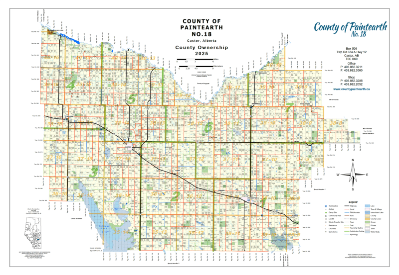


Navigate Paintearth County No. 18 with confidence. Whether you are an agricultural producer, a land developer, or an outdoor enthusiast, our landowner map provides the most current and detailed geographical data for the region, including Castor, Coronation, and Halkirk.
[View Map Preview] [Purchase High-Res Map]
Our County 18 map goes beyond basic geography. We provide a granular look at land status to help you make informed decisions:
Quarter Section Labeling: Every 1/4 section is clearly labeled with the current landowner’s name.
Color-Coded Land Types: Instantly identify land status with high-contrast visuals:
Green/Color-coded: Crown (Government) Lands
White/Neutral: Freehold (Private) Lands
Highlight Zones: Crown Leased Lands
Municipal Boundaries: Clear markers for towns, villages, and city limits.
Never get lost on rural backroads again. This map is updated with the latest transportation data:
Township & Range Roads: Essential for rural navigation and legal land descriptions.
Hydrography: Accurate locations for the Battle River, local lakes, and seasonal creeks.
Parks & Landmarks: Includes all provincial parks and protected natural areas within the county.
Agribusiness: For identifying neighboring landowners and planning crop rotations or grazing.
Energy & Utilities: Vital for surveyors and landmen locating specific parcels and access roads.
Recreation: A must-have for hunters and hikers looking to identify legal access to Crown lands.
Real Estate: A visual tool for evaluating property blocks and regional development.
County: Paintearth County No. 18 (Alberta)
Accuracy: Verified against municipal land titles and provincial records.
Does this map show Township and Range roads?Yes, our map includes a full grid of Township and Range roads for precise navigation.