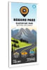
ROGERS PASS BACKROAD MAP. This water resistant map at 1:20,000 scale includes Highways, Logging Roads, Land & Water Features, Parks, Adventure Points of Interest, Campgrounds, Hiking Trails, Motorized Trails, Paddling Routes, Hunting & Fishing Areas, Winter Recreation and More.
Areas Covered: Glacier National Park, Rogers Pass, A O Wheeler Hut, Asulkan Valley Trail, Avalanche Glacier, Balu Pass, Illecillewaet Glacier, Loop Brook Campground, Mount Sir Donald Campground, BC, Canada