QUESTIONS? CALL OR TEXT! 1 (877) 921-6277 or (403) 266-2241
WE SHIP EVERYWHERE!

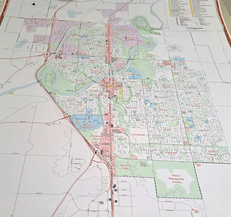



Navigate the city of Red Deer, Alberta with unparalleled detail using this comprehensive Red Deer wall map. Designed for clarity and function, it's the perfect addition to any home, office, or business.
Key Features:
Comprehensive Coverage: This map provides a detailed view of the entire city, including all major roads, railroads, and communities.
Essential Landmarks: Easily locate important services and landmarks. The map clearly shows fire halls, police stations, hospitals, RCMP detachments, churches, and libraries.
Points of Interest: Discover local highlights with major attractions, commercial areas, and green spaces all clearly marked. Find public amenities like parking lots and parks at a glance.
Easy Navigation: A full, alphabetized index is included, allowing you to quickly and easily find any street or road in the city.
Large & Clear Format: Measuring 35 inches by 56 inches, this large wall map is designed for easy viewing and durability.
Whether you're a new resident, a business owner needing a visual reference, or simply a map enthusiast, this wall map of Red Deer is an essential tool for understanding the city's layout.