QUESTIONS? CALL OR TEXT! 1 (877) 921-6277 or (403) 266-2241
WE SHIP EVERYWHERE!

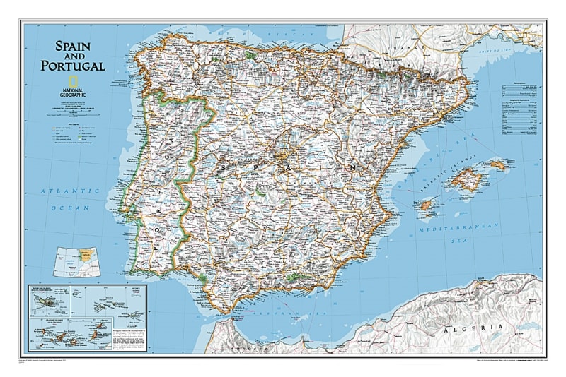
The Spain & Portugal Classic Wall Map – National Geographic provides a detailed and elegant view of the Iberian Peninsula. This wall map shows both Spain and Portugal in exceptional detail, including political boundaries, major cities, and surrounding islands.
Inset maps provide additional focus on major urban areas and islands, giving a comprehensive overview for educational, professional, or decorative use. Shaded relief and accurate cartography help highlight geographic features such as mountains, rivers, and coastlines.
Ideal for classrooms, offices, and homes, this map combines National Geographic’s precision with a classic wall map design, making it both functional and decorative. It’s perfect for travelers, students, map enthusiasts, or anyone interested in Spain and Portugal.
Detailed depiction of Spain and Portugal
Political boundaries, provinces, and regions clearly defined
Major cities labeled with inset maps for urban areas
Surrounding islands included with accurate geography
Shaded relief for mountains, rivers, and coastal areas
Elegant wall map suitable for study or display
Educational classrooms and geography study
Home or office wall decoration
Travel planning and reference
Researchers and map enthusiasts
Students learning about Spain and Portugal