QUESTIONS? CALL OR TEXT! 1 (877) 921-6277 or (403) 266-2241
WE SHIP EVERYWHERE!

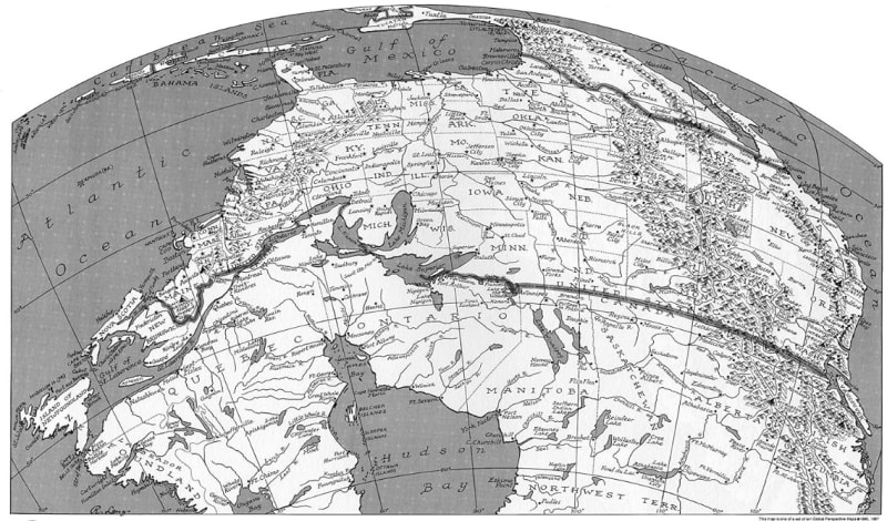
This is not just a map; it's a unique cartographic perspective!
The View: This is the captivating USA as seen from Canada—a truly disorienting and destabilizing view of North America. It is a south-on-top map, challenging the viewer's habituated biases.
The Artistry: An extraordinary example of map-making as art, this map features meticulously hand-drawn rivers and mountain ranges. All of the Russell Lenz maps are hand-lettered and shown in 3-D relief, with mountain ranges drawn in perspective.
Unique Features: The focus is on the physical relief features, with state divisions represented by subtle dotted lines. It provides a unique sense of what is "lost" when map-making is taken over by computer-driven GIS programs.
Context: This unusual perspective is also featured in the ODTmaps book, Seeing Through Maps, which explains how this contrary view helps us deconstruct our prejudices and biases.