QUESTIONS? CALL OR TEXT! 1 (877) 921-6277 or (403) 266-2241
WE SHIP EVERYWHERE!

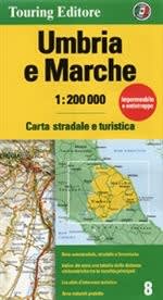
Venture beyond the crowds of Tuscany and into the authentic, rolling landscapes of Umbria and Marche. This Touring Edition travel map is meticulously crafted for explorers who want to trade the highway for the scenic route.
Whether you’re navigating the mystical hilltop towns of the "Green Heart" or following the rugged Apennine peaks to the Adriatic Sea, this waterproof, double-sided map ensures you have the clarity of a 1:200,000 scale right at your fingertips.
The Green Heart (Umbria): Master the winding roads to Assisi, Perugia, and Orvieto. Our map highlights the best routes to see the Gothic Duomo of Orvieto or the thundering Marmore Waterfalls, the tallest man-made falls in the world.
The Renaissance Coast (Marche): Discover the birthplace of Raphael in Urbino or explore the subterranean wonders of the Grotte di Frasassi. From the "Florence of the East" to the quiet beaches of the Conero Riviera, every hidden gem is marked.
Outdoor Adventure: Navigate the Sibillini Mountains National Park with shaded relief that brings the topography to life—perfect for hikers, cyclists, and those chasing the summer blooms of the Piano Grande.
Adventure-Ready Durability: Printed on waterproof and tear-resistant paper, this map is built for open-top cars, sudden mountain mists, and coffee spills at a local trattoria.
Comprehensive Logistics: Includes town-through routes, motorways with access points, distances in kilometers, and vital transit hubs like airports, car ferries, and cableways.
Visual Clarity: Features shaded relief to help you visualize the climbs and valleys of the Apennines before you drive them.
Easy Navigation: Includes a complete index of names and intuitive tourist symbols for historical landmarks and leisure spots.
While GPS is great for A-to-B driving, the Touring Edition allows you to see the connections between the medieval 'Borghi' (villages). It’s the best way to find the SP-109 and other minor provincial roads that offer the iconic 'patchwork quilt' views of the Italian countryside that digital apps often skip.