QUESTIONS? CALL OR TEXT! 1 (877) 921-6277 or (403) 266-2241
WE SHIP EVERYWHERE!



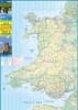
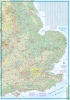
Unlock the diverse beauty of the United Kingdom with our Wales & Southwest England Travel & Road Map. Spanning from the soaring peaks of Snowdonia (Eryri) to the jagged cliffs of Land’s End, this double-sided map is engineered for the 2026 traveler who values the journey as much as the destination.
Modern travel is about seamless connectivity. Our map provides:
Ferry Routes & Real-World Times: Plan your maritime escapes with ease. Includes the latest sailing times for the Scillonian III to the Isles of Scilly and crossings from Poole and Portsmouth to the Channel Islands (Jersey, Guernsey, and Alderney).
Rail Renaissance: Features the comprehensive rail network across South Wales and the West Country, perfect for those choosing sustainable, unhurried rail travel.
Road Classifications: Distinguishes between major motorways for rapid transit and scenic "B-roads" for quintessential British road trips.
Wales and Southwest England are home to some of the world’s most iconic long-distance paths. Our map is color-coded to elevation, providing vital topographic context for:
South West Coast Path: Track all 630 miles of England’s longest National Trail.
Offa’s Dyke Path: Navigate the historic border between England and Wales.
Pembrokeshire Coast Path: Explore the rugged headlands of the UK’s only truly coastal National Park.
Cotswold Way: Trace the limestone escapement from Chipping Campden to the Roman city of Bath.
Don't miss a single detail with dedicated inset maps of:
The Channel Islands: Detailed coverage of Jersey and Guernsey.
Isles of Scilly: Navigate the archipelago’s white-sand beaches and the sub-tropical Tresco Abbey Garden.
Elevation Detail: Clearly marked peaks including Snowdon (Yr Wyddfa) and the tors of Dartmoor, ensuring you’re prepared for the terrain ahead.