QUESTIONS? CALL OR TEXT! 1 (877) 921-6277 or (403) 266-2241
WE SHIP EVERYWHERE!



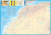
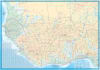
Navigate the ultimate terrestrial challenge with the most authoritative Western Africa Travel & Road Map. Designed specifically for the intrepid traveler crossing the continent from Europe to Central and Southern Africa, this map provides the granular detail necessary for off-grid survival and complex border logistics.
Where digital maps often fail or provide outdated "ghost roads," this regional map offers unsurpassed accuracy. It is the definitive cartographic resource for the "Triple Frontier". Road quality information is based on practical field reports.
The Most Detailed Records Yet: Navigate the challenging terrains of Guinea, Guinea-Bissau, Liberia, and Sierra Leone with confidence.
Vast Coverage: Spans from the southern tip of Spain and Morocco through Mauritania and the Bight of Benin states, reaching as far east as Western Nigeria.
Trans-African Highway Ready: Perfect for tracking the Trans-West African Coastal Highway, connecting the major economic and cultural hubs of the coast.
In West Africa, a "National Highway" can range from a modern freeway to a seasonal mud track. Our map prioritizes road quality over road designation, providing:
Real-World Surface Data: Distinguishes between paved, gravel, and seasonal tracks, allowing you to plan your journey based on vehicle capability and seasonal weather (rainy vs. dry).
Cross-Border Essentials: Highlights critical border crossings, ferry points, and transit hubs essential for international overland trucks and 4WD expeditions.
Overland Tested: Ideal for the classic "London to Cape Town" or "Paris to Dakar" routes.
Topographical Awareness: Includes physical features and elevation to help drivers prepare for mountain passes in the Fouta Djallon or Saharan dune crossings.
Indexed for Ease: Quickly find remote settlements and waypoints that are often missing from standard continental maps.
| Feature | Standard Continental Map | Our Western Africa Regional Map |
| Road Detail | Major highways only | Primary, secondary, and remote tracks |
| Data Type | Official designation (Highways) | Practical quality (Paved vs. Unpaved) |
| Regional Focus | Broad/General | Deep-dive into Guinea, Liberia, Sierra Leone |
| Transit Focus | Airports | Border crossings, ferries, and fuel waypoints |