QUESTIONS? CALL OR TEXT! 1 (877) 921-6277 or (403) 266-2241
WE SHIP EVERYWHERE!


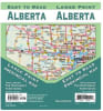
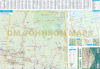
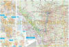
The Alberta Large Print Road Map is an easy-to-read, comprehensive travel map designed for drivers, RV travelers, campers, and road-trippers navigating Western Canada. Featuring crisp, oversized typography and high-contrast cartography, this folding province map removes the strain from vehicle navigation, ensuring you can quickly identify routes, distances, and key points of interest at a glance.
Clear Highway & Road Networks: Detailed coverage of primary provincial highways, secondary connector routes, rural backroads, and driving distances with clear point-to-point mileage markers.
Extensive Campground Directory: Features clearly marked provincial parks, national parks, commercial campgrounds, and recreational vehicle (RV) staging areas across Alberta.
Large Print Legibility: Built with oversized text labels, highly visible town markers, and distinct boundary lines for effortless reading on the road or in your vehicle.
To help you transition smoothly from highway driving to urban navigating, this map includes high-detail city and park insets for:
Calgary & Edmonton: Major metro highway corridors, ring roads, and primary arterial thoroughfares.
Banff & Jasper National Parks: Detailed regional layout of Canada's premier Rocky Mountain park corridors and townsite approaches.
Yellowknife, Northwest Territories (NWT): Bonus regional inset covering the route into Yellowknife and the surrounding NWT highway system.
Whether you are touring the Canadian Rockies, hauling an RV along the Trans-Canada Highway, or commuting between major urban hubs, the GM Johnson Alberta Large Print Map provides a reliable offline alternative to digital GPS navigation.