QUESTIONS? CALL OR TEXT! 1 (877) 921-6277 or (403) 266-2241
WE SHIP EVERYWHERE!


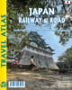
Japan Railway & Road Travel Atlas | Detailed Shinkansen, Subway & Highway Map Guide
Navigate Japan with confidence using the Japan Railway & Road Travel Atlas, the definitive guide for independent explorers. Whether you are traversing the country via the iconic Shinkansen (Bullet Train) or embarking on a scenic road trip along national highways, this atlas provides unmatched cartographic detail.
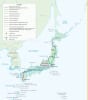
Complete Transit Coverage: Includes Japanese National Rail, privatized lines, trams, monorails, and ferry routes.
Driver-Friendly Mapping: Features a full hierarchy of roads, from major expressways to secondary and minor local routes.
Expert City Guides: Detailed regional and city maps for Tokyo, Kyoto, Nara, Osaka, and Kobe, including district names and zone highlights.
Subway & Rail Hubs: Dedicated, enlarged subway maps for every major city featured.
Cultural Points of Interest: Easily locate UNESCO World Heritage sites, temples, shrines, national parks, and resorts.
Topographic Detail: Beautifully rendered altitude coloring and spot heights for a clear view of Japan’s mountainous terrain.