QUESTIONS? CALL OR TEXT! 1 (877) 921-6277 or (403) 266-2241
WE SHIP EVERYWHERE!

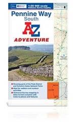
Seamlessly navigate the rugged peaks, exposed moorlands, and historic trails of the UK’s oldest National Trail with the A-Z Adventure Atlas of the Pennine Way (South). Perfectly tailored for long-distance hikers, weekend walkers, and outdoor adventurers, this atlas brings the gold standard of British cartography directly into a highly convenient, pocket-friendly book format.
This innovative atlas covers the entire southern half of the iconic trail, mapping 207 kilometres (129 miles) of the total route from the official starting point in Edale, Derbyshire, up to Bowes in the North Pennines. By utilizing standard Ordnance Survey Explorer mapping across 44 pages of continuous coverage, this book completely eliminates the frustrating hassle of folding and re-folding a massive sheet map in high winds or rain. Simply flip the page to stay on track as you journey north.
Featuring the unparalleled accuracy of Ordnance Survey’s most detailed recreational mapping at a crisp 1:25 000 scale, this atlas ensures you have every piece of critical terrain and logistical data at your fingertips:
Trail & Land Access: Clearly highlights all public rights of way, National Park boundaries, and open access land for confident backcountry exploration.
On-the-Trail Logistics: Easily locate vital trail amenities including car parks, tourist information centers, and public houses (pubs) for daytime breaks.
Overnight Planning: Identifies official camping and caravan sites along the trail corridor to help streamline your multi-day itinerary.
Comprehensive Index: Includes a full, built-in index to help you instantly locate specific geographical features, villages, and landmarks.