QUESTIONS? CALL OR TEXT! 1 (877) 921-6277 or (403) 266-2241
WE SHIP EVERYWHERE!


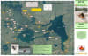
Navigate the premier whitewater playground of Northern Saskatchewan with the precision-engineered Barker Lake Whitewater Area Satellite Canoe Map. Developed in conjunction with regional backcountry outfitters, this custom, high-resolution satellite imagery map is explicitly designed for whitewater canoeists, playboat kayakers, and river expedition teams. Covering the dynamic channels of the legendary Churchill River system, this map provides an unfiltered, overhead view of the aquatic terrain at an ultra-detailed 1:12,000 scale, allowing you to analyze eddy lines, river structures, and island networks with unmatched visual clarity.
Measuring 30" x 19", this specialized cartographic guide functions as an elite tactical blueprint for both technical river running and basecamp logistics. The map completely removes the guesswork from navigating this high-energy wilderness corridor by cataloging every rapid, portage, and resting zone across the lake.
Advanced Rapid Directory: Plots all runnable whitewater drops and features in the Barker Lake area, complete with official names and accurate International Scale of River Difficulty classifications (Class I to IV+).
Expedition Staging: Pinpoints established backcountry campgrounds, prime wilderness campsites on Barker Island, and the exact locations of composting/pit toilets to ensure highly organized, low-impact camp management.
Portage Paths & Trails: Clearly maps out critical portage bypasses—including the vital trails around volatile chutes like Sluice Falls—saving valuable time and protecting your gear.
Environmental Context: Includes overlays highlighting recent forest fire burn zones from the past decade alongside a precise UTM grid for advanced GPS coordination.
Printed on high-quality, high-contrast presentation paper, this map offers exceptionally sharp aerial image crispness, making it perfect for pre-trip route planning at home or keeping secure inside a transparent dry-bag window on the water. The map comes pre-folded and securely packaged in a durable, protective plastic sleeve that fits effortlessly into your pack or transparent bow bag.