QUESTIONS? CALL OR TEXT! 1 (877) 921-6277 or (403) 266-2241
WE SHIP EVERYWHERE!

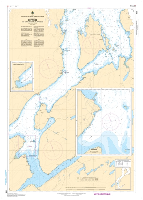
Navigate the historic and industrially vital shipping lanes of Notre Dame Bay, Newfoundland, with our premium-grade marine map covering Botwood and Approaches. This highly detailed nautical chart is an essential reference for commercial mariners, recreational boaters, coastal fishermen, and cartography collectors tracking the waters of the Bay of Exploits leading into the port of Botwood.
Featuring precise depth soundings, clear shoreline topography, and accurate placements of local islands, channels, and underwater hazards, this map provides the tactical clarity needed for safe passage through these deep-water approaches. Whether you are charting a physical cruise through these traditional Newfoundland shipping routes or seeking a striking piece of maritime art to frame for your home, cottage, or office, this map perfectly blends functional reliability with visual excellence. Printed on durable, high-quality media, it is designed to withstand active onboard marine conditions or serve as an elegant, long-lasting display piece.