QUESTIONS? CALL OR TEXT! 1 (877) 921-6277 or (403) 266-2241
WE SHIP EVERYWHERE!


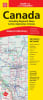
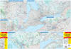
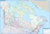
Navigate the nation with confidence using the Canada Folded Road Map (1299). Designed for cross-country road trips, commercial transport, and regional travel, this detailed folded map combines a big-picture national overview with essential regional insets to provide complete, accurate cartographic coverage across all ten provinces and three territories.
Proudly made in Canada, this map utilizes multi-scale cartography to balance macro-level navigation with granular regional details:
National Map of Canada (1:6,000,000): Comprehensive national context spanning from coast to coast to coast.
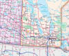
Western Canadian Provinces (1:1,875,000): Regional coverage across British Columbia, Alberta, Saskatchewan, and Manitoba.
Ontario (1:1,000,000): Detailed coverage for Canada's most populous province.
Québec (1:1,250,000): High-clarity mapping across Québec's major transit corridors.
Atlantic Provinces (1:900,000): Dense detail for navigating New Brunswick, Nova Scotia, Prince Edward Island, and Newfoundland & Labrador.
Alongside multi-scale map sections, this guide includes a Canadian Cities Distance Chart to rapidly calculate driving distances between major metropolitan hubs.
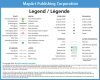
Complete Highway Networks: Highlights the Trans-Canada Highway, Yellowhead Route, U.S. Interstate connections, divided highways, and toll expressways.
Differentiated Road Surfaces: Clearly distinguishes between primary paved highways, secondary routes, gravel roads, and seasonal/unimproved backroads.
Recreational & Geographic Landmarks: Features national and provincial park boundaries, wildlife reserves, international/provincial borders, time zones, and city populations.
Essential Travel Features: Pinpoints key ferry service routes, water transit connections, and northern ice limits.
Compact, easy to fold, and built to store neatly in any glove compartment or seatback pocket, the Canada Folded Map (1299) is an indispensable offline backup for driving across Canada.