QUESTIONS? CALL OR TEXT! 1 (877) 921-6277 or (403) 266-2241
WE SHIP EVERYWHERE!


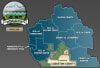
The Cardston County Landowner Map (Municipal District No. 6) is an essential, highly detailed reference map designed for rural landowners, agricultural producers, land negotiators, real estate professionals, energy companies, and outdoor enthusiasts in southern Alberta. Providing complete coverage of Cardston County, this high-precision regional map delivers clear, up-to-date surface land ownership records mapped across the Dominion Land Survey (DLS) grid down to every quarter section ($1/4$ section).
Detailed Parcel Ownership: Every quarter section is explicitly labeled with the registered landowner's name, making it easy to perform property identification, land assessment, and rural boundary checks.
Color-Coded Land Classifications: Distinct color coding instantly distinguishes between Freehold (private land), Crown (government-owned land), and Crown Leased lands for quick verification of land status and public access zones.
Updated Rural Road Network: Features current transportation infrastructure, including provincial highways, secondary roads, local access tracks, and clearly labeled Township and Range roads.
Municipalities & Regional Landmarks: Outlines urban centers, towns, villages, and hamlets across the district—including Cardston, Magrath, Glenwood, and Hill Spring—along with provincial parks, lakes, and river systems.
Border & Regional Position: Captures the unique geographic landscape bordering Glacier National Park / Waterton Lakes area and the US-Canada Montana border.
Whether you are managing agricultural holdings, researching property boundaries, negotiating resource rights, or navigating backroads across southern Alberta, the Cardston County MD 6 Landowner Map serves as an indispensable physical reference.