QUESTIONS? CALL OR TEXT! 1 (877) 921-6277 or (403) 266-2241
WE SHIP EVERYWHERE!

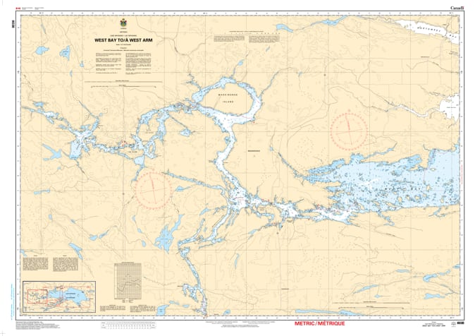
Navigate the intricate and scenic western reaches of Lake Nipissing with the professional precision of Nautical Chart 6038. This official hydrographic map provides essential, high-resolution coverage for the passage from West Bay to the West Arm, capturing one of the most popular and complex boating and fishing corridors in Northern Ontario.
Chart 6038 is a vital tool for mariners exploring the narrow channels, numerous islands, and sheltered bays that define the lake's western extension. Given the region’s rugged Canadian Shield geography, the chart features detailed bathymetric soundings to identify hazardous rocky shoals, submerged obstructions, and varying depth contours. It provides the exact positioning of all navigational aids and marks safe passage routes through the West Arm's winding waterways. Whether you are a dedicated angler seeking hidden fishing holes or a recreational boater heading toward Mashkinonje Provincial Park, this chart offers the professional accuracy required for safe and confident navigation.
Key Features:
Detailed Western Reach Coverage: Comprehensive mapping from the entrance of West Bay through the length of the West Arm.
Hydrographic Precision: Features updated depth data and bottom characteristics essential for navigating the shallow and rocky western inlets.
Safety & Navigation: Clear identification of buoyed channels, lights, and landmarks vital for navigating the narrow and island-dense West Arm.
Adventure & Fishing Essential: The primary resource for boaters exploring the remote beauty and world-class fishing grounds of western Lake Nipissing.