QUESTIONS? CALL OR TEXT! 1 (877) 921-6277 or (403) 266-2241
WE SHIP EVERYWHERE!

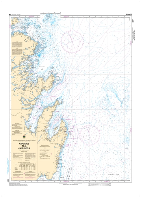
Navigate the eastern seaboard of Newfoundland with the Official CHS Chart 4017. This critical coastal chart provides comprehensive coverage from Cape Race to Cape Freels, encompassing the high-traffic waters of the Avalon and Bonavista Peninsulas.
As a genuine Canadian Hydrographic Service (CHS) publication, Chart 4017 is an indispensable resource for commercial vessels, fishing fleets, and offshore adventurers. This region includes the eastern approaches to St. John's, the rugged shores of Conception Bay, and the historic waters of Trinity and Bonavista Bays. With the North Atlantic's unpredictable conditions, having the precise bathymetry, shoreline detail, and navigational aid data provided by this official chart is essential for safe transit.
Key Features include:
Extensive Eastern Coverage: Detailed mapping of the Newfoundland coast from the southeastern tip at Cape Race up to Cape Freels.
Official Data Accuracy: Compiled by the CHS to ensure full compliance with maritime safety regulations and carriage requirements.
Complex Coastal Detail: Includes precise soundings for deep bays, offshore banks, and the intricate island systems of the eastern shore.
Navigational Hazards: Clear identification of the rocks, ledges, and shoals that define the "Rock's" challenging coastline.