QUESTIONS? CALL OR TEXT! 1 (877) 921-6277 or (403) 266-2241
WE SHIP EVERYWHERE!

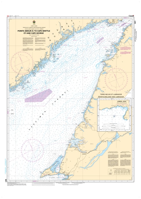
Navigate the rugged North Shore of the Gulf of St. Lawrence with the Official CHS Chart 4021. This essential coastal chart provides detailed coverage from Pointe Amour (at the Strait of Belle Isle) across to Cape Whittle, Quebec, and down to Cape George, Newfoundland.
As a genuine Canadian Hydrographic Service (CHS) publication, Chart 4021 is a critical resource for mariners transiting the northeastern Gulf. This region is a vital corridor for shipping traffic moving between the Strait of Belle Isle and the St. Lawrence River. Due to the complex shoreline of the Quebec North Shore and the deep waters of the Esquiman Channel, this chart offers the authoritative bathymetry and navigational data required for a safe and professional passage.
Key Features include:
Broad Northeastern Gulf Coverage: Detailed mapping of the waters between the Labrador coast, the Quebec North Shore, and Western Newfoundland.
Official Data Accuracy: Compiled by the CHS to ensure full compliance with maritime safety regulations and carriage requirements.
Hydrographic Precision: Features clear depth soundings, seafloor contours, and coastal topography for the Jacques-Cartier Strait and surrounding areas.
Navigational Hazards & Aids: Clearly identifies prominent lights, such as the Pointe Amour lighthouse, as well as offshore shoals and traffic routes.