QUESTIONS? CALL OR TEXT! 1 (877) 921-6277 or (403) 266-2241
WE SHIP EVERYWHERE!

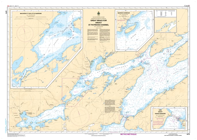
Navigate the heart of Cape Breton’s world-famous cruising grounds with the CHS Nautical Chart 4278. Produced by the Canadian Hydrographic Service (CHS), this official nautical chart is the primary resource for mariners traversing the Great Bras d'Or channel and St. Patricks Channel, including the essential approaches to the village of Baddeck.
This chart is indispensable for those navigating the central reaches of the Bras d'Or Lakes. It provides high-resolution bathymetric data and shoreline details for the expansive St. Patricks Channel, a popular destination for recreational sailors and home to the Alexander Graham Bell National Historic Site. Chart 4278 ensures safe passage through the region's varying depths and past its numerous islands and coves.
Key Navigational Features:
Bilingual Official Data: Comprehensive hydrographic information provided in both English and French (Great Bras d'Or / Grand Bras d'Or).
Baddeck & Area Coverage: Detailed soundings and navigational aids for the waters surrounding Baddeck, a major hub for yachting and tourism in Nova Scotia.
Hydrographic Precision: Features up-to-date depth soundings, seabed composition, and tidal information crucial for safe anchoring and channel transit.
Navigational Aids: Clearly identifies all buoys, lights, beacons, and shore-based landmarks necessary for daytime and nighttime navigation.
Durable & Professional: Printed on high-quality paper to meet the rigorous carriage requirements for both commercial and recreational vessels in Canadian waters.
Whether you are a local resident, a commercial operator, or a cruising sailor visiting from afar, Chart 4278 provides the reliable data needed to explore the stunning central waterways of Cape Breton Island.