QUESTIONS? CALL OR TEXT! 1 (877) 921-6277 or (403) 266-2241
WE SHIP EVERYWHERE!

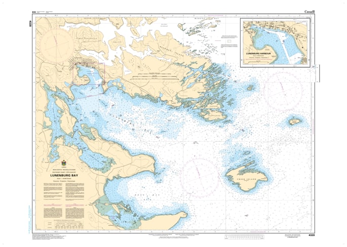
Navigate the waters of Canada’s most famous fishing port with the CHS Nautical Chart 4328: Lunenburg Bay. Produced by the Canadian Hydrographic Service (CHS), this official nautical chart is the definitive resource for mariners entering the UNESCO World Heritage site of Old Town Lunenburg.
At a high-resolution scale, Chart 4328 provides critical bathymetric data for Lunenburg Bay, Lunenburg Harbour, and the approaches from the Atlantic Ocean. This area is a high-traffic zone for world-class sailing vessels (including the Bluenose II), commercial fishing fleets, and international cruisers. The chart offers precise information on water depths, wharf locations, and the numerous submerged hazards surrounding Cross Island and the entrance to the bay.
Key Navigational Features:
Harbour Detail: Includes high-detail soundings for the inner harbour, identifying safe approaches to the historic waterfront and commercial docks.
Official Hydrography: Features up-to-date depth soundings, seabed characteristics, and tidal data essential for safe maneuvering in a busy port.
Aids to Navigation: Clearly identifies the iconic Lunenburg lighthouses, offshore buoys, and range lights used for precision entry.
Safety & Hazards: Pinpoints the ledges and rocks common to the South Shore, ensuring the safety of deep-draft vessels and recreational craft alike.
Professional Grade: Printed on durable, heavy-duty paper to meet official carriage requirements for vessels operating in Canadian waters.
Whether you are a professional mariner or a recreational sailor visiting this historic Nova Scotia gem, Chart 4328 is an essential piece of equipment for your navigation desk.