QUESTIONS? CALL OR TEXT! 1 (877) 921-6277 or (403) 266-2241
WE SHIP EVERYWHERE!

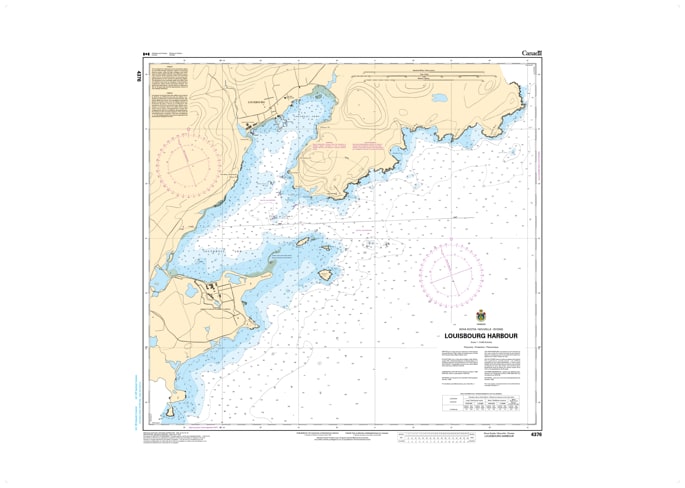
Navigate one of North America’s most historic and strategic ports with the Canadian Hydrographic Service (CHS) Nautical Chart 4376. This high-resolution harbor chart provides the definitive tactical view of Louisbourg Harbour, Nova Scotia. Unlike broader coastal maps, Chart 4376 is produced at an exceptional 1:9,600 scale, offering the extreme detail required for safely entering the narrow channel and mooring within the sheltered waters of the harbor.
As an official CHS publication, this chart is indispensable for mariners visiting the Fortress of Louisbourg National Historic Site or utilizing the commercial and fishing facilities in the modern port. It features ultra-precise bathymetric soundings (in metres), clearly defining the navigable depths of the central basin and the approach between Lighthouse Point and Battery Island. Every critical aid to navigation is included—from the legendary Louisbourg Light to modern buoys, daymarks, and fog signals. Updated to the latest Notice to Mariners (NTM), Chart 4376 identifies submerged hazards, historical wrecks, and shoreline infrastructure with the accuracy demanded by commercial captains and the clarity desired by recreational sailors.
Chart Number: 4376
Scale: 1:9,600 (High-resolution harbor detail)
Region: Atlantic Coast (Cape Breton Island, East Coast)
Coverage: Complete interior of Louisbourg Harbour and immediate seaward approaches.
Dimensions: Approx. 31" x 36" (Image size: 27" x 28").
Format: Printed on heavy-duty kraft paper; meets official carriage requirements for vessels in Canadian waters.
Harbor Entrance Detail: Specialized cartography for the narrow entrance between Lighthouse Point and the rocky shoals of Battery Island.
Anchorage & Berthing: Clearly marked anchorage areas and wharf depths for commercial and recreational use.
Historical Landmarks: Indicates prominent features of the Fortress of Louisbourg used for visual navigation.
Bathymetry: Features high-density depth soundings (typically in metres) to assist in docking and maneuvering in confined waters.