QUESTIONS? CALL OR TEXT! 1 (877) 921-6277 or (403) 266-2241
WE SHIP EVERYWHERE!

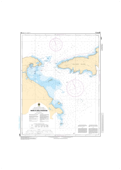
Navigate the intricate and strategically vital waters of eastern Cape Breton with the Canadian Hydrographic Service (CHS) Nautical Chart 4377. This high-resolution marine chart provides definitive coverage of the Main-à-Dieu Passage, the essential thoroughfare separating the mainland of Nova Scotia from the rugged shores of Scatarie Island. Mapped at a precise 1:18,000 scale, this chart offers the granular detail required for safe passage through this complex coastal corridor.
As an official CHS publication, Chart 4377 is a mandatory resource for mariners navigating the easternmost tip of Cape Breton. It features comprehensive bathymetric soundings (in metres) and detailed seafloor characteristics, which are crucial for avoiding the submerged rocks and shoals common in the passage. The chart provides accurate positioning for all major navigation aids, including the Moque Head and Scatarie lights, as well as critical buoys and daymarks. Updated to the latest Notice to Mariners (NTM), this chart is indispensable for fishing vessels, commercial shipping, and recreational boaters looking to navigate the currents and narrow channels between the Atlantic Ocean and Mira Bay with absolute confidence.
Chart Number: 4377
Scale: 1:18,000 (Detailed coastal scale)
Region: Atlantic Coast (Eastern Cape Breton Island, NS)
Coverage: Main-à-Dieu Passage, Scatarie Island (West Coast), Moque Head, and the approaches to Main-à-Dieu Harbour.
Dimensions: Approximately 34" x 36" (Image size: 30" x 24").
Format: Printed on heavy-duty, high-quality paper; meets official carriage requirements for commercial vessels in Canadian waters.
Detailed Passage Navigation: High-scale cartography for navigating the narrow waters between mainland Cape Breton and Scatarie Island.
Aids to Navigation: Precise locations and light characteristics for Scatarie, Moque Head, and coastal buoys.
Safety Information: Clearly identifies shipwrecks, submerged obstructions, and dangerous shoals within the passage.
Tidal & Current Data: Includes relevant notes on local water movements and hazards specific to the Cape Breton east coast.