QUESTIONS? CALL OR TEXT! 1 (877) 921-6277 or (403) 266-2241
WE SHIP EVERYWHERE!

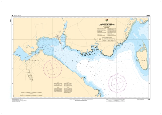
Navigate the historic waters of the South Shore with the Canadian Hydrographic Service (CHS) Nautical Chart 4379. This high-resolution harbor chart provides the definitive tactical view of Liverpool Harbour, Nova Scotia. Specifically engineered for close-quarters maneuvering, Chart 4379 is produced at an exceptional 1:8,400 scale, offering the extreme detail required for safely transiting the Mersey River approaches and the sheltered waters of the inner basin.
As an official CHS publication, this chart is an indispensable resource for mariners visiting the "Port of the Privateers." It features meticulous bathymetric soundings (in metres), clearly defining the navigable channels and mooring depths from Coffin Island to the Liverpool town waterfront. Every critical aid to navigation is included—from the Fort Point Light to precise buoy placements, daymarks, and fog signals. Updated to the latest Notice to Mariners (NTM), Chart 4379 identifies submerged hazards, tidal variations, and shoreline infrastructure with the accuracy demanded by commercial shipping and the clarity desired by recreational sailors exploring the beautiful Queens County coastline.