QUESTIONS? CALL OR TEXT! 1 (877) 921-6277 or (403) 266-2241
WE SHIP EVERYWHERE!

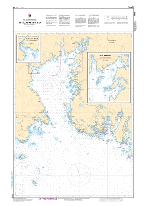
Navigate one of Nova Scotia’s most beloved and expansive coastal inlets with the Canadian Hydrographic Service (CHS) Nautical Chart 4386. This official marine chart provides high-resolution coverage of St. Margaret’s Bay, a premier destination for recreational sailors, commercial fishers, and coastal explorers. Mapped at a detailed 1:38,000 scale, Chart 4386 offers the precise data needed to navigate the bay’s deep waters, intricate island groups, and charming harbors like Peggy’s Cove and Hubbard’s.
As an official CHS publication, this chart is the gold standard for safety in the waters between the Aspotogan Peninsula and the Chebucto Peninsula. It features comprehensive bathymetric soundings (in metres) and meticulous seafloor detailing, which are essential for navigating the transitions from the open Atlantic into the sheltered reaches of the bay. The chart provides accurate positioning for all major navigation aids, including the iconic Peggy’s Point Lighthouse and the lights at Croucher Island and Indian Harbour. Whether you are tracing the rugged eastern shore, anchoring in the scenic islands of the western bay, or docking at local marinas, Chart 4386 ensures you have the most reliable, updated data at your helm.
Chart Number: 4386
Scale: 1:38,000
Region: Atlantic Coast (South Shore, Nova Scotia)
Coverage: Complete St. Margaret’s Bay area, including Peggy’s Cove, Indian Harbour, Hubbards, Mill Cove, and the Aspotogan Peninsula.
Dimensions: Approximately 34" x 46" (Standard large format).
Format: Printed on heavy-duty kraft paper; meets official carriage requirements for vessels in Canadian waters.
Island & Cove Detail: Detailed mapping of the bay’s interior, including the numerous islands and sheltered coves perfect for anchoring.
Aids to Navigation: Precise locations and light characteristics for all major lighthouses, fog signals, and coastal buoys.
Safety Information: Clearly identifies hazardous rocky shoals, submerged obstructions, and the powerful Atlantic swell entry points.
Bathymetry: High-density depth contours and spot soundings (in metres) to assist in safe passage through the deep-water bay and shallower shoreline areas.