QUESTIONS? CALL OR TEXT! 1 (877) 921-6277 or (403) 266-2241
WE SHIP EVERYWHERE!

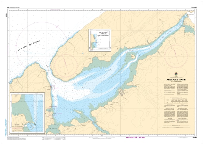
Navigate the powerful tides and historic waters of the Bay of Fundy's most famous inlet with the Canadian Hydrographic Service (CHS) Nautical Chart 4396. This official marine chart provides high-resolution coverage of the Annapolis Basin, including the critical transit through the Digby Gut. Mapped at a detailed 1:20,000 scale, Chart 4396 is the definitive resource for mariners entering the sheltered waters of the basin, home to the world-famous Digby scallop fleet and the historic town of Annapolis Royal.
As an official CHS publication, this chart is meticulously engineered to handle the extreme tidal range of the region. It features comprehensive bathymetric soundings (in metres) and detailed seafloor composition, essential for navigating the deep-water channel of the Gut and the shallower flats of the inner basin. The chart provides accurate positioning for all major navigation aids, including the Prim Point Light, the Digby pier markers, and the buoys guiding vessels toward Cornwallis and the Annapolis River. Updated to the latest Notice to Mariners (NTM), Chart 4396 identifies submerged hazards, tidal current speed notes, and shoreline infrastructure with the precision required for commercial shipping, ferry operations, and recreational sailing.
Chart Number: 4396
Scale: 1:20,000 (Detailed basin scale)
Region: Bay of Fundy / Atlantic Coast (Nova Scotia)
Coverage: Digby Gut, Prim Point, Digby Harbour, Bear River entrance, and the full extent of the Annapolis Basin to Annapolis Royal.
Dimensions: Approximately 32" x 46".
Format: Printed on heavy-duty kraft paper; meets official carriage requirements for vessels in Canadian waters.
Digby Gut Entrance: Specialized cartography for the narrow, high-current passage between the Bay of Fundy and the Basin.
Tidal Information: Crucial notes on tidal currents and depth variations specific to the extreme Fundy environment.
Aids to Navigation: Precise locations and light characteristics for Prim Point and harbor approach buoys.
Safety Information: Clearly identifies the rugged shoreline, submerged rocks, and shifting sediment areas near the mouth of the Annapolis River.