QUESTIONS? CALL OR TEXT! 1 (877) 921-6277 or (403) 266-2241
WE SHIP EVERYWHERE!

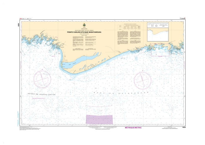
Navigate the remote and breathtaking landscape of the Basse-Côte-Nord with the Canadian Hydrographic Service (CHS) Nautical Chart 4454. This official marine chart provides essential coverage for the Quebec North Shore, spanning from Pointe Curlew to Baie Washtawouka. Mapped at a detailed 1:70,000 scale, Chart 4454 is a primary navigational tool for mariners transiting the Gulf of St. Lawrence along this rugged, island-strewn stretch of the eastern Mingan region.
As an official CHS publication, this chart is engineered to handle the technical challenges of the North Shore's granite coastline. It features comprehensive bathymetric soundings (in metres) and meticulous seafloor detailing, which are critical for identifying safe passages through the numerous submerged ledges and rocky outcrops. The chart provides accurate positioning for all coastal aids to navigation, including lights and daymarks essential for navigating the approaches to Baie Washtawouka. Updated to the latest Notice to Mariners (NTM), Chart 4454 is a mandatory resource for commercial vessels, local fishing fleets, and offshore sailors who require precise data to navigate the powerful currents and complex topography of the Gulf.
Chart Number: 4454
Scale: 1:70,000
Region: Gulf of St. Lawrence (North Shore / Côte-Nord, Quebec)
Coverage: Coastal waters from Pointe Curlew eastward to Baie Washtawouka, including the various offshore shoals and island clusters.
Dimensions: Approximately 33" x 47" (Standard large format).
Format: Printed on heavy-duty kraft paper; meets official carriage requirements for vessels in Canadian waters.
Coastal Transit Detail: High-resolution mapping of the transition between deep-water Gulf routes and the intricate inner-shore channels.
Bathymetric Precision: High-density depth contours (in metres) to assist in navigating the jagged underwater topography typical of the Côte-Nord.
Aids to Navigation: Precise locations and light characteristics for all major beacons and markers along the transit.
Safety Information: Clearly identifies shipwrecks, submerged rocks, and areas of restricted navigation or high tidal influence.