QUESTIONS? CALL OR TEXT! 1 (877) 921-6277 or (403) 266-2241
WE SHIP EVERYWHERE!

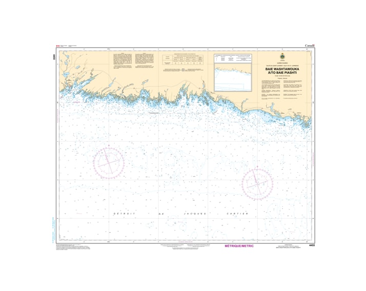
Navigate the intricate and wild eastern reaches of the Côte-Nord with the Canadian Hydrographic Service (CHS) Nautical Chart 4455. This official marine chart provides high-resolution coverage of the Gulf of St. Lawrence shoreline, spanning from Baie Washtawouka to Baie Piashti, Quebec. Mapped at a detailed 1:70,000 scale, Chart 4455 is the indispensable guide for mariners navigating the granite-bound coastline near the communities of Aguanish and Baie-Johan-Beetz.
As an official CHS publication, this chart is specifically designed to manage the technical complexities of the "Basse-Côte-Nord." It features comprehensive bathymetric soundings (in metres) and meticulous seafloor detailing, vital for transiting the narrow channels between the numerous rocky islands and submerged ledges that define this region. The chart provides accurate positioning for all coastal aids to navigation, including the markers for the Goynish River and the approaches to the sheltered harbor of Baie Piashti. Updated to the latest Notice to Mariners (NTM), Chart 4455 identifies submerged hazards, tidal current patterns, and the rugged coastal topography with the precision required for local fishing fleets, research vessels, and intrepid recreational sailors.
Chart Number: 4455
Scale: 1:69,950
Region: Gulf of St. Lawrence (North Shore / Côte-Nord, Quebec)
Coverage: Baie Washtawouka, Aguanish (Goynish River), Baie-Johan-Beetz, and the inner island passages leading to Baie Piashti.
Dimensions: Approximately 33" x 46" (Standard large format).
Format: Printed on heavy-duty kraft paper; meets official carriage requirements for vessels in Canadian waters.
River Mouth Detail: Specialized mapping of the Aguanish area, highlighting the shallow waters and sandbars near the river entrance.
Island Archipelago Navigation: Precise bathymetry for the granite islands and rocky shoals that provide natural but hazardous shelter along the coast.
Aids to Navigation: Accurate positioning and light characteristics for the sector lights and daymarks used to enter the small harbors.
Safety Information: Clearly identifies the rugged shoreline, submerged rocks, and the varying currents influenced by the freshwater discharge from the North Shore rivers.