QUESTIONS? CALL OR TEXT! 1 (877) 921-6277 or (403) 266-2241
WE SHIP EVERYWHERE!

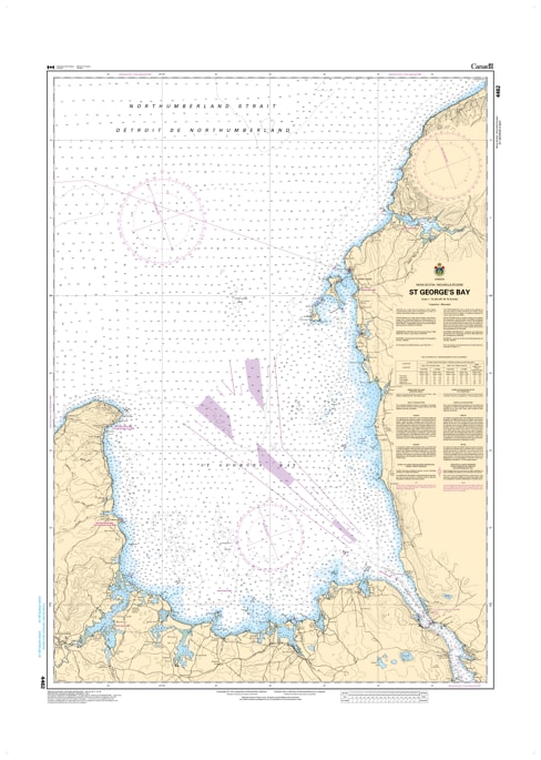
Navigate the pivotal waters connecting the Northumberland Strait to the Strait of Canso with the unmatched accuracy of CHS Nautical Chart 4462. Providing comprehensive coverage of St. Georges Bay, this chart is an essential resource for mariners traversing the maritime crossroads of Northeastern Nova Scotia and Western Cape Breton. This region is a vital corridor for commercial shipping, industrial transit, and some of the most productive lobster and bluefin tuna fishing grounds in Atlantic Canada.
Chart 4462 offers high-resolution hydrographic data for the entire bay, stretching from Cape George in the west to the rugged cliffs of Judique in the east. It provides critical mapping for the northern approaches to the Canso Causeway and the Strait of Canso, a deep-water superport of international significance. Whether you are a commercial pilot guiding a bulk carrier, a local fisher out of Ballantyne's Cove, or a recreational sailor crossing from Prince Edward Island, this official Canadian Hydrographic Service chart provides the soundings, navigational aids, and coastal detail necessary for safe and efficient passage.
Key Features include:
Comprehensive Bay Coverage: Spans the wide reaches of St. Georges Bay, including the northern entrance to the Canso Lock and the Gulf of St. Lawrence transition.
Deep-Water Bathymetry: Features precise depth soundings and seabed composition essential for deep-draft vessels entering the Strait of Canso.
Navigation-Critical Infrastructure: Clearly identifies lighthouses at Cape George and North Canso, along with all primary bell buoys and lighted markers.
Safety & Hazard Identification: Highlights the "Graham Shoal," rocky ledges near the Antigonish coastline, and the unpredictable currents of the "Gut of Canso."
Professional Grade: Produced to the rigorous standards of the Canadian Hydrographic Service (CHS) for professional navigation, maritime logistics, and GIS analysis.