QUESTIONS? CALL OR TEXT! 1 (877) 921-6277 or (403) 266-2241
WE SHIP EVERYWHERE!

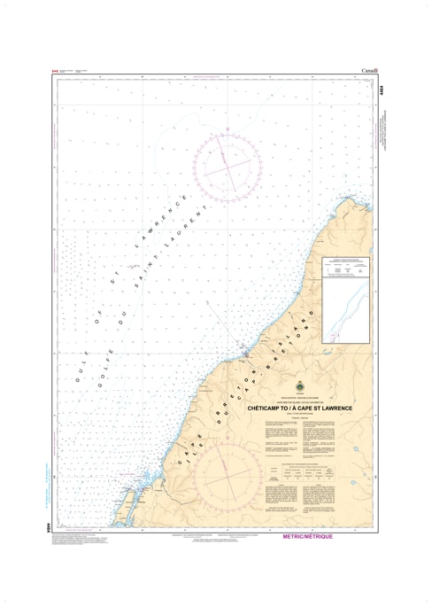
Navigate the northernmost tip of Nova Scotia with the professional precision of CHS Nautical Chart 4464. Providing comprehensive coverage from the harbor of Chéticamp to Cape St. Lawrence, this chart is the definitive hydrographic resource for the rugged "Top of the Island." This region is characterized by the towering cliffs of the Cape Breton Highlands National Park, deep-water drops, and the turbulent meeting of the Gulf of St. Lawrence and the Cabot Strait.
Chart 4464 offers critical mapping for mariners traversing the wilderness coastline of Victoria and Inverness Counties. It features detailed data for the waters surrounding Pleasant Bay, Presqu'île, and the remote, current-swept reaches of Pointe Enragée. Whether you are a commercial fisher operating in the deep basins off the Highlands or a high-seas sailor rounding the northern tip of Cape Breton toward the Atlantic, this official Canadian Hydrographic Service chart provides the soundings, navigational aids, and coastal topography necessary for safe passage in these exposed and often fog-shrouded waters.
Key Features include:
High-North Coastal Coverage: Spans the dramatic coastline from Chéticamp, past the Highlands National Park, to the remote Cape St. Lawrence.
Hydrographic Accuracy: Features precise depth soundings for the steep underwater shelves and offshore banks typical of the Northern Gulf.
Navigation-Critical Infrastructure: Clearly identifies the Chéticamp Island light, the Caveau Point range, and the essential buoyage for the Northern Cape Breton circuit.
Safety & Hazard Identification: Highlights the "Deadman's Bank," rocky ledges near Cap Rouge, and the powerful tidal rips of the Cabot Strait transition.
Professional Grade: Produced to the rigorous standards of the Canadian Hydrographic Service (CHS) for professional navigation, maritime safety, and GIS spatial analysis.