QUESTIONS? CALL OR TEXT! 1 (877) 921-6277 or (403) 266-2241
WE SHIP EVERYWHERE!

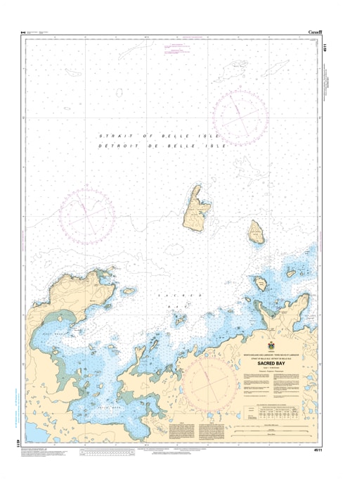
Navigate the historic and rugged waters of the northernmost tip of Newfoundland with the precision of CHS Nautical Chart 4511. Providing high-resolution coverage of Sacred Bay, this chart is an essential hydrographic resource for mariners exploring the coastlines near the Strait of Belle Isle. This region is world-renowned as the home of L’Anse aux Meadows National Historic Site, the only authenticated Norse site in North America, making these waters as culturally significant as they are navigationally demanding.
Chart 4511 offers detailed mapping of the bay’s intricate islands and sheltered inlets, including Great Sacred Island, Little Sacred Island, and the approaches to the communities of Ship Cove and Cape Onion. Given the area’s exposure to the open Atlantic and the frequent presence of icebergs drifting through "Iceberg Alley," the accurate depth soundings and hazard identifications provided by the Canadian Hydrographic Service are vital. Whether you are a recreational sailor following the wake of the Vikings, a commercial fisher operating near Medee Bay, or a tour boat operator, this chart provides the soundings, navigational aids, and coastal topography necessary for safe passage.
Key Features include:
Detailed Bay Coverage: Comprehensive mapping of Sacred Bay, its numerous rocky islets, and the strategic entrance from the North Atlantic.
Hydrographic Accuracy: Features precise depth soundings and seabed composition essential for navigating the shallow passages between the Sacred Islands.
Navigation-Critical Infrastructure: Clearly identifies the Cape Onion light, local wharves, and the essential buoyage for the Northern Peninsula circuit.
Safety & Hazard Identification: Highlights the "Flat Rock" ledges, submerged pinnacles, and the coastal currents common to the Cape Bauld region.
Professional Grade: Produced to the rigorous standards of the Canadian Hydrographic Service (CHS) for professional navigation, heritage site management, and GIS spatial analysis.