QUESTIONS? CALL OR TEXT! 1 (877) 921-6277 or (403) 266-2241
WE SHIP EVERYWHERE!

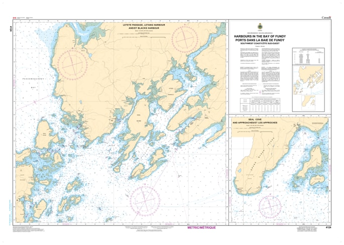
Navigate the intricate coastal inlets of the "Quoddy" region with the CHS Chart 4124: Harbours in the Bay of Fundy – Southwest Coast. Produced by the Canadian Hydrographic Service (CHS), this specialized nautical chart is an essential resource for mariners, commercial fishers, and recreational boaters navigating the dynamic, high-tide waters of southwestern New Brunswick.
This chart is unique in that it provides high-resolution, large-scale inset plans for several key harbours along the coast. It is designed to offer the granular detail necessary for docking and anchoring in areas with extreme tidal ranges and strong currents. Featured locations typically include the vital approaches to St. Andrews, Black’s Harbour, and Beaver Harbour, among others. At specialized scales (often ranging from 1:10,000 to 1:20,000), it provides the most accurate depth soundings and shoreline data available for these specific maritime hubs.
Key Features include:
Multi-Harbour Coverage: Detailed plans for strategic landing points along the Charlotte County coastline.
Large-Scale Accuracy: Provides the high resolution required for navigating narrow channels, wharf approaches, and sheltered anchorages.
Extreme Tidal Data: Essential for calculating clearance in the Bay of Fundy, where water levels fluctuate significantly twice daily.
Navigational Essentials: Clearly marks buoys, light stations, fog signals, and underwater hazards such as rocks and drying shoals.
Official CHS Publication: Meets federal carriage requirements and serves as the authoritative standard for marine safety in the Fundy Isles region.