QUESTIONS? CALL OR TEXT! 1 (877) 921-6277 or (403) 266-2241
WE SHIP EVERYWHERE!

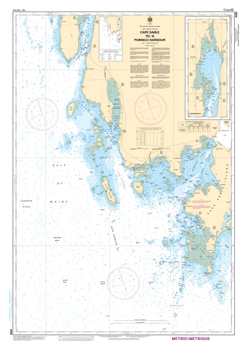
Navigate the challenging "graveyard of the Atlantic" with the CHS Chart 4210: Cape Sable to Pubnico Harbour. Produced by the Canadian Hydrographic Service (CHS), this essential nautical chart provides detailed coverage of the southernmost tip of Nova Scotia, where the Atlantic Ocean meets the Gulf of Maine.
This region is famous for its dense fogs, powerful tidal currents, and complex underwater topography. Rendered at a detailed 1:40,000 scale, Chart 4210 is a critical resource for the commercial fishing fleet and coastal mariners. It covers the strategic waters surrounding Cape Sable, the southernmost point of the province, and extends northwest to the sheltered waters of Pubnico Harbour. The chart provides the precise bathymetry required to navigate the intricate channels, rocky ledges, and numerous islands—such as the Mud Islands and the Tusket Islands fringes—that define this treacherous coastal stretch.
Key Features include:
Strategic Southern Coverage: Detailed mapping of the Cape Sable Light station area and the approaches to the vital fishing hub of Pubnico.
Hydrographic Precision: Features authoritative depth soundings, seabed characteristics, and meticulously identified submerged hazards.
Navigational Aids: Clearly marks all seasonal buoys, lighthouses, fog signals, and range lights essential for visual positioning in low visibility.
Tidal Influence Data: Provides critical information for calculating clearance in an area known for significant tidal rips and surges.
Official Safety Standard: An authoritative CHS publication meeting federal carriage requirements and serving as the primary safety tool for the South Shore maritime community.