QUESTIONS? CALL OR TEXT! 1 (877) 921-6277 or (403) 266-2241
WE SHIP EVERYWHERE!

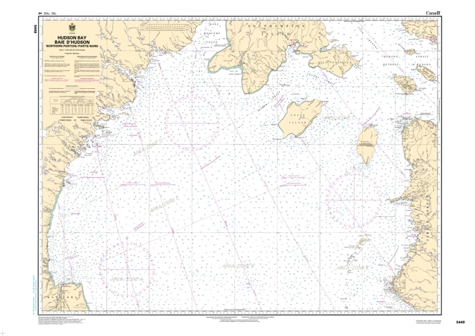
Navigate the vast and challenging waters of Canada’s North with the authoritative detail of CHS Nautical Chart 5449. Covering the Northern Portion of Hudson Bay (Baie d'Hudson), this large-scale chart (1:1,000,000) is a critical resource for mariners, commercial shippers, and Arctic researchers. As a primary "road map" for the Central and Arctic Region, Chart 5449 provides the essential hydrographic data required to navigate the high-latitude corridor connecting the heart of the bay to the Hudson Strait and Foxe Channel.
This chart offers a comprehensive overview of the subarctic maritime environment, featuring precise depth soundings, seabed composition, and coastal configurations of the Nunavut and Manitoba shorelines. Given the extreme tidal ranges, seasonal ice movements, and magnetic anomalies unique to the North, the accuracy of an official Canadian Hydrographic Service (CHS) chart is indispensable. Whether you are supporting community resupply missions (sealift), conducting oceanic research, or navigating the remote approaches to Southampton Island and Coats Island, Chart 5449 delivers the reliable data needed for safe passage in these unpredictable waters.
Key Features include:
Expansive Northern Coverage: Maps the upper reaches of Hudson Bay, including the strategic waters surrounding Mansel Island, Coats Island, and the southern approaches to Roes Welcome Sound.
High-Latitude Hydrography: Features essential depth soundings and bathymetric data tailored for deep-draft commercial vessels and ice-class ships.
Safety & Hazard Identification: Clearly marks submerged hazards, shoals, and remote islands critical for navigating in low-visibility or ice-congested conditions.
Arctic Navigational Aids: Includes the latest information on remote beacons, seasonal buoyage, and coastal elevations used for radar and visual fixes.
Professional Grade: Produced to the rigorous standards of the Canadian Hydrographic Service (CHS), meeting the carriage requirements of the Canada Shipping Act for vessels operating in Arctic waters.