QUESTIONS? CALL OR TEXT! 1 (877) 921-6277 or (403) 266-2241
WE SHIP EVERYWHERE!

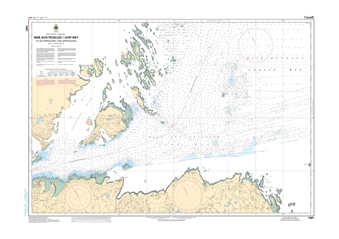
The Canadian Hydrographic Service (CHS) Chart 5467 is an official, high-precision marine navigation chart engineered for commercial shipping fleets, industrial supply vessels, and Arctic operators navigating Ungava Bay along the northern coast of Nunavik, Quebec. Published at a detailed scale of 1:50,000, this authoritative nautical asset provides critical "ground-truth" coastal data required for safe passage planning, shallow-water maneuvering, and harbour approach routing into Baie aux Feuilles (Leaf Bay) and its surrounding approaches—a region famous for experiencing some of the most extreme tidal ranges on Earth.
Detailed High-Resolution Approach Mapping: Delivers continuous, high-definition charting across the complex island channels, tidal basins, and coastal features defining Leaf Bay along the western shore of Ungava Bay.
Official Bathymetric & Seafloor Data: Packed with precise localized depth soundings, undersea contour lines, low-tide marine benchmarks, and subarctic reef hazards essential for managing safe draft clearance and secure anchoring under volatile tidal conditions.
Essential Aids to Navigation: Explicitly details official maritime buoys, coastal light stations, daybeacons, and prominent shoreline topography to ensure maximum situational awareness during low-visibility subarctic conditions, fog, or night transits.
Premium Multi-Light Legibility: Printed with vibrant, high-contrast marine inks specifically engineered to maintain absolute clarity under both direct pilothouse sunlight and dim red-light night-deck setups.
Legal Vessel Compliance: Fully satisfies international SOLAS (Safety of Life at Sea) carriage regulations and Canada Shipping Act mandates for commercial and recreational vessels requiring official hydrographic documentation.