QUESTIONS? CALL OR TEXT! 1 (877) 921-6277 or (403) 266-2241
WE SHIP EVERYWHERE!

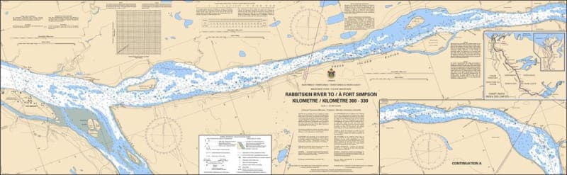
The Canadian Hydrographic Service (CHS) Chart 6409 is an official, government-authorized river navigation chart designed for commercial barge operators, tug captains, supply vessels, and northern paddlers. This vital hydrographic publication covers Kilometres 300 to 330 of the Mackenzie River system, detailing the highly navigated shipping corridor from the Rabbitskin River to Fort Simpson (Lı́ı́dlıı́ Kų́ę́) in the Northwest Territories.
Mackenzie River Corridor Charting: Delivers highly accurate, continuous coverage of the river navigation channel, islands, and shifting sandbars from the Rabbitskin River outlet down to the confluence at Fort Simpson.
Official Riverine Bathymetry: Features localized depth soundings, channel markers, low-water datum references, and warning indicators for dangerous gravel bars, fast currents, and rocky shoals.
Essential Aids to Navigation: Explicitly details official Canadian Coast Guard river buoys, daymarks, range lights, compass roses, and shore-based landmark references to ensure safe pilotage.
High-Contrast Multi-Light Legibility: Printed with premium, high-contrast marine inks specifically formulated to remain perfectly clear and readable under intense subarctic summer daylight or the dim light of a vessel's wheelhouse.
Official Marine Compliance: Fully satisfies vessel carriage regulations and Canada Shipping Act mandates for commercial transport and supply vessels requiring official CHS charting for the Mackenzie River system.