QUESTIONS? CALL OR TEXT! 1 (877) 921-6277 or (403) 266-2241
WE SHIP EVERYWHERE!

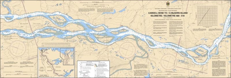
The Canadian Hydrographic Service (CHS) Chart 6412 is an official, government-authorized river navigation chart designed for commercial tug and barge operators, supply fleets, regional river pilots, and wilderness expedition paddlers. This vital hydrographic chart provides detailed coverage of Kilometres 460 to 510 along the Mackenzie River system, spanning the key transit section from Camsell Bend to McGern Island in Canada's Northwest Territories.
Mackenzie River Corridor Charting: Delivers continuous, highly precise coverage of river channels, shoreline profiles, and island passages between Camsell Bend and McGern Island.
Official Riverine Bathymetry: Features localized depth soundings, channel flow markings, low-water datum reference levels, and critical hazard warnings for gravel bars, shifting sandbanks, and fast currents.
Essential Aids to Navigation: Explicitly details official Canadian Coast Guard river buoys, range lights, daymarks, compass roses, and shore-based landmark references for safe pilotage.
High-Contrast Multi-Light Legibility: Printed using premium, high-contrast marine inks specifically formulated to remain perfectly legible under bright subarctic summer daylight or dim wheelhouse red lighting.
Official Marine Compliance: Fully satisfies mandatory vessel carriage regulations and Canada Shipping Act requirements for commercial transport, logistics, and resource operations navigating the Mackenzie River waterway.