QUESTIONS? CALL OR TEXT! 1 (877) 921-6277 or (403) 266-2241
WE SHIP EVERYWHERE!

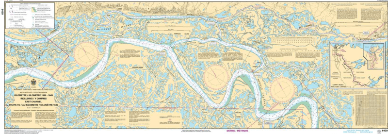
The Canadian Hydrographic Service (CHS) Chart 6429 is an official, government-authorized nautical navigation chart engineered for commercial tug and barge captains, supply fleets, northern pilots, and river expeditionists. This vital hydrographic publication covers Kilometres 1580 to 1645 of the Mackenzie River system, mapping the critical shipping corridor along the East Channel from Inuvik to Kilometre 1645 in Canada's Northwest Territories.
Mackenzie River East Channel Charting: Delivers seamless, high-precision coverage of main river channels, bank contours, and island passages surrounding Inuvik and the upper East Channel delta routes.
Official Riverine Bathymetry: Features accurate localized depth soundings, channel flow vectors, low-water datum reference levels, and essential hazard markers for shallow gravel bars, mudflats, and fast currents.
Essential Aids to Navigation: Explicitly details official Canadian Coast Guard river buoys, range markers, daybeacons, compass roses, and shore-based landmark references for safe piloting.
High-Contrast Multi-Light Legibility: Printed with premium, high-contrast marine inks specifically formulated to remain clear and easily readable in direct subarctic sunlight or low-light wheelhouse conditions.
Official Marine Compliance: Fully satisfies mandatory vessel carriage regulations and Canada Shipping Act requirements for commercial transport and resource vessels operating on the Mackenzie River.