QUESTIONS? CALL OR TEXT! 1 (877) 921-6277 or (403) 266-2241
WE SHIP EVERYWHERE!

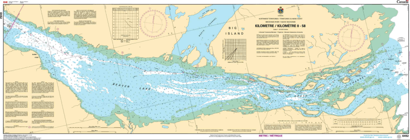
Navigate the headwaters of Canada's longest river system with the CHS Chart 6452: Mackenzie River / Fleuve Mackenzie (Kilometre 0-58). Produced by the Canadian Hydrographic Service (CHS), this essential nautical chart covers the critical transition from the western basin of Great Slave Lake into the beginning of the Mackenzie River, spanning the first 58 kilometres of the waterway.
Rendered at a detailed 1:50,000 scale, this chart is a primary requirement for commercial vessels, barge pilots, and recreational explorers navigating the "Deh Cho." It provides vital hydrographic data for the stretch between Great Slave Lake and Beaver Lake, including the complex channels and shifting sandbars characteristic of the river's entrance. Mariners will find comprehensive information on water depths (bathymetry), shoreline configurations, and critical aids to navigation such as buoys and beacons.
Key Features include:
Official Navigational Data: The authoritative source for depth soundings and hazard identification in the upper Mackenzie River.
1:50,000 Scale Clarity: Provides the necessary resolution for identifying safe passage through the river's initial reach.
Strategic Coverage: Maps the vital corridor from the outlet of Great Slave Lake (Km 0) westward to the Beaver Lake area (Km 58).
Nautical Essentials: Features detailed information on currents, bottom composition, and prominent landmarks for visual pilotage.
Regulatory Compliance: Meets official carriage requirements for commercial vessels operating in the Northwest Territories when kept up-to-date with Notices to Mariners.