QUESTIONS? CALL OR TEXT! 1 (877) 921-6277 or (403) 266-2241
WE SHIP EVERYWHERE!

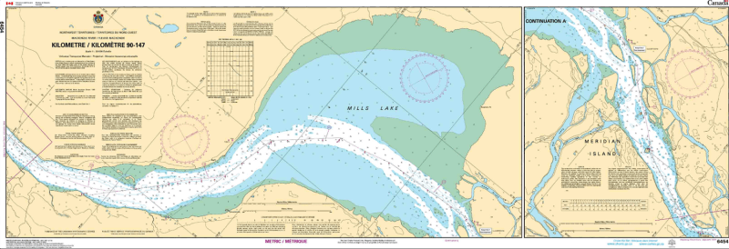
The Canadian Hydrographic Service (CHS) Chart 6454 is an official, government-authorized nautical chart expertly produced for commercial tug operators, supply barge captains, northern pilots, and wilderness river navigators. This critical inland hydrographic publication provides highly detailed strip-map coverage of the Mackenzie River (Fleuve Mackenzie) from Kilometer 90 to Kilometer 147, including key regional waterways like Mills Lake and routes flanking Meridian Island within Canada's Northwest Territories.
Continuous River Sector Mapping: Provides unbroken, high-precision charting of the main riverbed, bank topology, and wide lake-like expansions across the designated Kilometer 90 to 147 corridor.
Official Riverine Bathymetry: Features highly specific depth soundings, low-water datum reference levels, channel flow dynamics, and critical warnings for shifting sandbars, gravel shoals, and underwater river hazards.
Essential Aids to Navigation: Explicitly layouts official Canadian Coast Guard river buoys, shoreline range markers, steering indicators, transit daybeacons, and localized compass roses for maintaining accurate headings.
High-Contrast Multi-Light Legibility: Printed with premium marine-grade inks to ensure the chart remains perfectly legible and clear under direct northern sunlight or dim wheelhouse conditions during midnight sun navigation.
Official Marine Compliance: Fully satisfies mandatory vessel carriage regulations and Canada Shipping Act requirements for commercial resupply, transport, and resource vessels operating along the Mackenzie River transit corridors.