QUESTIONS? CALL OR TEXT! 1 (877) 921-6277 or (403) 266-2241
WE SHIP EVERYWHERE!

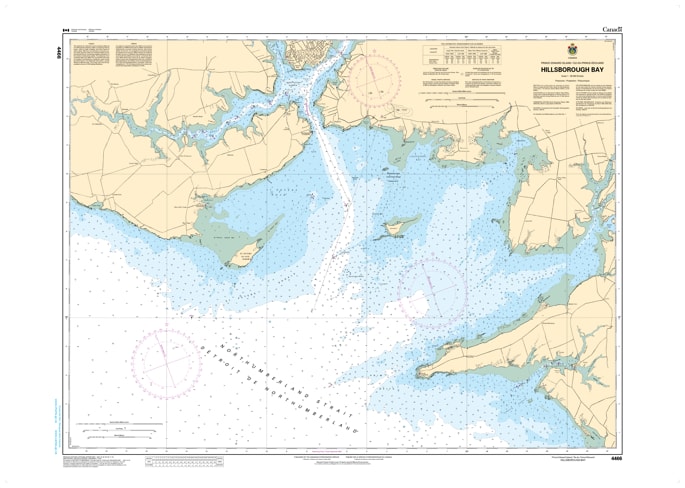
Master the primary maritime gateway to Prince Edward Island with the professional accuracy of CHS Nautical Chart 4466. Providing comprehensive coverage of Hillsborough Bay, this chart is the definitive hydrographic resource for mariners navigating the southern coast of PEI. As the expansive approach to the capital city of Charlottetown, Hillsborough Bay is a dynamic environment featuring significant tidal flats, deep-water shipping lanes, and the confluence of three major river systems.
Chart 4466 offers high-resolution mapping from the Northumberland Strait entrance at Point Prim and Governor Island through the inner bay to the harbour limits. It provides critical data for the commercial vessels, cruise ships, and recreational sailors who must navigate the bay's shifting sands and well-marked channels. Whether you are identifying the best anchorage near St. Peters Island or tracking the range lights into the West, North, and Hillsborough Rivers, this official Canadian Hydrographic Service chart provides the precise soundings and coastal detail necessary for safe transit.
Key Features include:
Extensive Bay Coverage: Detailed mapping of the entire Hillsborough Bay area, including the strategic approaches to Charlottetown Harbour.
Hydrographic Precision: Features high-accuracy depth soundings and seabed composition data essential for navigating the bay’s complex shoals.
Navigation-Critical Infrastructure: Clearly identifies the historic Point Prim Lighthouse, the Blockhouse Point range, and all essential maritime buoyage.
Safety & Hazard Identification: Highlights the dangerous Fitzroy Rock, the St. Peters Island reefs, and the extensive drying flats unique to the Queens County shoreline.
Professional Grade: Produced to the rigorous standards of the Canadian Hydrographic Service (CHS) for professional navigation, maritime safety, and GIS spatial analysis.