QUESTIONS? CALL OR TEXT! 1 (877) 921-6277 or (403) 266-2241
WE SHIP EVERYWHERE!

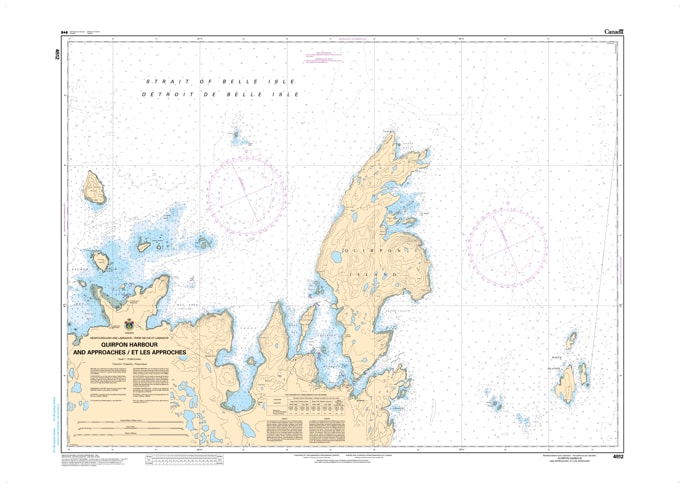
Navigate the historic and strategic waters of the easternmost entrance to the Strait of Belle Isle with the professional precision of CHS Nautical Chart 4512. Providing high-resolution coverage of Quirpon Harbour and Approaches, this chart is an essential hydrographic resource for mariners traversing the rugged "top" of Newfoundland. Quirpon Island and its sheltered harbour have served as a vital landmark for centuries, from early Basque whalers and French fishers to modern-day coastal explorers and commercial fishers.
Chart 4512 offers detailed mapping of the narrow, current-swept "tickles" and deep-water approaches surrounding Quirpon Island. It provides critical data for the passage between Cape Bauld—a major waypoint for North Atlantic shipping—and the mainland of the Great Northern Peninsula. Whether you are a recreational sailor visiting the historic Quirpon Lighthouse, a commercial fisher navigating the treacherous Jacques Cartier Strait transition, or an iceberg tour operator, this official Canadian Hydrographic Service chart delivers the precise soundings and coastal topography necessary for safe pilotage in this high-energy maritime environment.
Key Features include:
Detailed Harbour Plans: Large-scale mapping of the inner Quirpon Harbour and the narrow passages of Quirpon Tickle.
Hydrographic Accuracy: Features high-density depth soundings essential for navigating the rocky pinnacles and steep-to cliffs of the Cape Bauld region.
Navigation-Critical Infrastructure: Clearly identifies the Cape Bauld Lighthouse, the Quirpon range lights, and local wharf structures.
Safety & Hazard Identification: Highlights the dangerous "Merchantman Rocks," submerged ledges, and the powerful tidal rips common to the northern tip of Newfoundland.
Professional Grade: Produced to the rigorous standards of the Canadian Hydrographic Service (CHS) for professional navigation, maritime safety, and GIS spatial analysis.