QUESTIONS? CALL OR TEXT! 1 (877) 921-6277 or (403) 266-2241
WE SHIP EVERYWHERE!

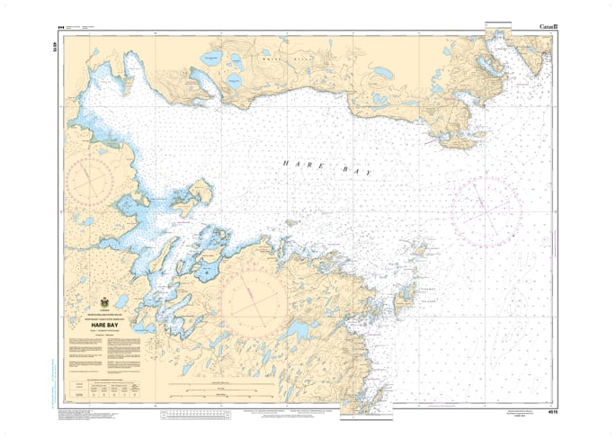
Explore one of the largest and most ecologically diverse inlets on the Great Northern Peninsula with the authoritative detail of CHS Nautical Chart 4515. Providing comprehensive coverage of Hare Bay, this chart is an essential hydrographic resource for mariners navigating the eastern shores of Northern Newfoundland. Hare Bay is a vast maritime environment characterized by its numerous islands, deep-water arms, and the Hare Bay Islands Ecological Reserve, a critical habitat for common eiders and other seabirds.
Chart 4515 features high-resolution mapping of the bay’s expansive waters, including the strategic approaches to the town of Main Brook. It offers critical data for navigating the complex network of islands, such as Brent Island and the Spring Island group. Whether you are a commercial fisher operating in the fertile grounds of the Great Northern Peninsula, a recreational sailor seeking the sheltered anchorage of Ariège Bay, or a researcher monitoring the region's unique limestone barrens and marine life, this official Canadian Hydrographic Service chart delivers the soundings, navigational aids, and coastal topography necessary for safe pilotage.
Key Features include:
Extensive Bay Coverage: Detailed mapping of the entire Hare Bay system, including its northern and southern arms and the Salmon River estuary.
Hydrographic Precision: Features high-accuracy depth soundings and seabed composition essential for navigating the bay’s deep basins and rocky shoals.
Navigation-Critical Infrastructure: Clearly identifies the Main Brook public wharves, local beacons, and the essential buoyage for the inner bay transit.
Safety & Hazard Identification: Highlights the "Fischot Islands" ledges, submerged rocks near Goose Tickle, and the coastal currents of the open Atlantic approach.
Professional Grade: Produced to the rigorous standards of the Canadian Hydrographic Service (CHS) for professional navigation, environmental management, and GIS spatial analysis.